RF & Signal Intelligence
Detect relevant radio activity and place unusual or unknown emissions into their spatial and temporal context.
Maritime Intelligence from the Air
A persistent airborne sensor platform for maritime situational awareness, RF intelligence, AIS verification and the investigation of jamming, spoofing and other anomalies.
Persistent Maritime Awareness
The platform correlates RF, position, movement and optical information directly where it matters: above the operating area.
It can observe large maritime areas for many hours, detect unusual signals and movement patterns and rapidly reposition to investigate suspicious locations. Electronically transmitted positions can be compared with independent sensor observations and verified.

One Platform. Multiple Sensors.
Operational value comes from correlating independent data sources rather than looking at a single sensor in isolation.
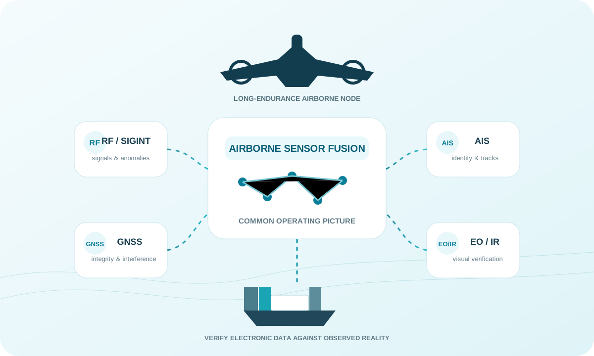
Detect relevant radio activity and place unusual or unknown emissions into their spatial and temporal context.
Receive AIS data, analyze vessel movements and compare reported positions with additional observations.
Camera and EO/IR payloads can independently confirm contacts and compare electronic positions with the real-world situation.
Investigate unusual GNSS conditions and potential jamming or spoofing events in the maritime environment.
Expose contradictions between signals, movement and observed positions and prioritize them for further investigation.
Fuse multiple sensors and aircraft into a shared, dynamic maritime operating picture.
AIS & Optical Verification
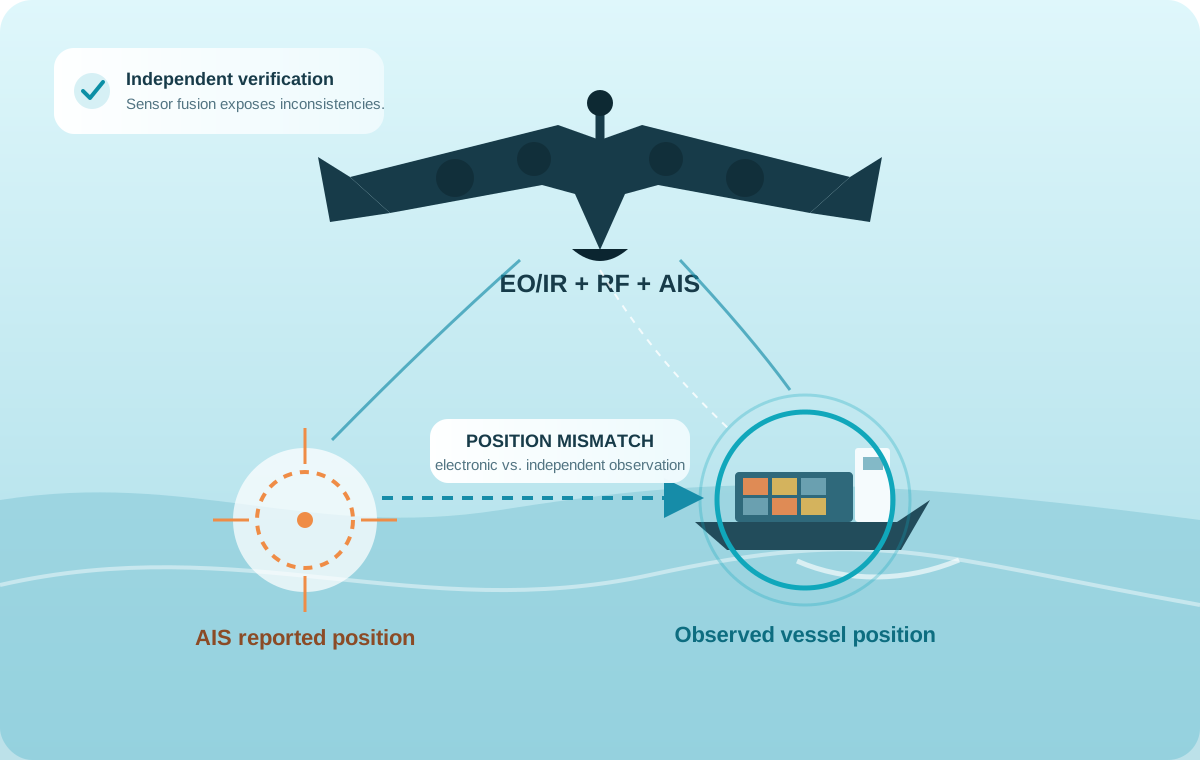
A transmitted position is a data point, not a guarantee. The platform can compare electronic reports with independent airborne observations.
By correlating AIS, GNSS or other position information with an actually observed contact, spatial inconsistencies become visible immediately. Suspicious jumps, implausible tracks or possible spoofing situations can then be prioritized and investigated.
The Airborne Sensor Node
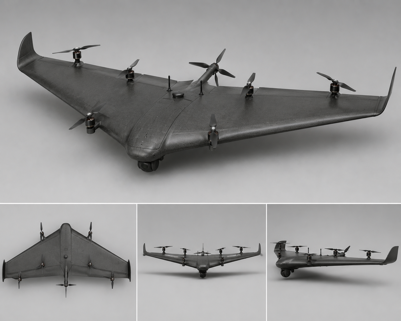
The CarryAir platform combines fixed-wing efficiency with VTOL flexibility and provides space for extensive electronics and mission-specific sensors.
Distributed Airborne Sensing
Multiple spatially separated UAVs can observe the same signal from different positions and combine their measurements.
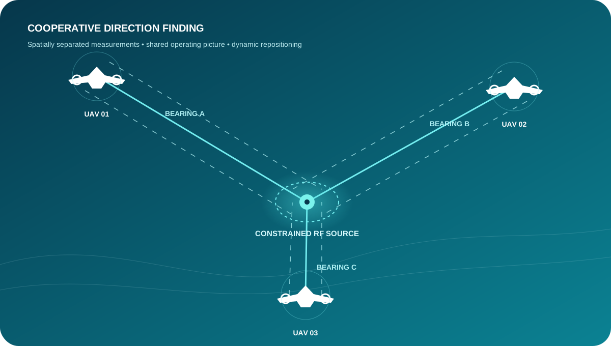
With suitable sensor payloads, the network enables cooperative direction-finding and geolocation techniques: suspicious emissions can be constrained from multiple bearings while other aircraft continue area surveillance or visually verify a contact.
From Signal to Situation
Collect RF activity, AIS, movements and additional sensor data.
Connect independent sources in time and space.
Identify anomalies, prioritize them and assess operational relevance.
Check electronic information using optical or other independent sensors.
Investigate contacts of interest and constrain signal sources cooperatively.
Maritime Applications
Persistent, mobile observation of vessel traffic, sea lanes and defined operating areas.
Compare electronically reported positions and identities with independent airborne observations.
Investigate unusual or unknown radio activity with a rapidly deployable airborne sensor platform.
Detect and spatially investigate possible jamming and spoofing events in coastal and offshore areas.
Mobile monitoring of offshore installations, cable corridors, energy infrastructure and sensitive maritime zones.
Multiple aircraft support spatial constraint of suspicious signal sources from different observation positions.
Mission Ready
The platform can be adapted to different sensor packages, operating areas and mission profiles. Let’s discuss coverage, payloads and data integration.
Get in touch